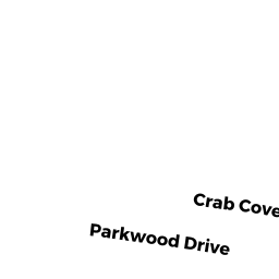
33 CRAB COVE TERR
Owner Information
NELSON MARK R
PO BOX 338
W WAREHAM, MA 02576


Property Details
33 CRAB COVE TERR is classified as a Single Family Residential (Cape cod).
The primary structure on this property was built in 1939. There are 2,256ft2 of built area within this property. There is 915ft2 of residential/living space within this property. This property is listed as having 6 rooms.
33 CRAB COVE TERR is valued at $287,100. The land is valued at $169,800 and the structures are valued at $116,900. There is an additional valuation of $400 on this property.
This property is in Zone R30. Confirm with local Zoning Board authorities to ensure there are no overlays or other easements on this property.
The most recent deed for 33 CRAB COVE TERR is recorded at the local registrar in Book 25695, Page 0350. 33 CRAB COVE TERR was last sold on Monday, July 7, 2003 for $0.
Assessment data from fiscal year 2022.
Flood Data
This property has multiple flood prone designations.
| Zone | Description | BFE | Area |
|---|---|---|---|
| AE | within floodplain | 15 | 0.04 (25.26%) |
| VE | coastal flooding with wave action | 19 | 0.0 (0.85%) |
This information is sourced from the FEMA National Flood Hazard Layer. See our full disclamer.
Broadband Internet Providers
| Provider | Type | Bandwidth (mbps) | |
|---|---|---|---|
| Verizon New England Inc. | DSL | 3 | 0 |
| Viasat Inc | Satellite | 35 | 3 |
| Comcast | Cable | 1000 | 35 |
| HughesNet | Satellite | 25 | 3 |
| VSAT Systems, LLC. | Satellite | 2 | 1 |
| Verizon New England Inc. | Fiber | 940 | 880 |
| GCI Communication Corp. | Satellite | 0 | 0 |
Broadband service provider data from December 2020.
Adjacent Properties
- 0 TERRY LN
Improved, Selectmen or City Council (Municipal) owned by TOWN OF WAREHAM - 0 FONSECA WY
Undevelopable Residential Land owned by CORNERSTONE ESTATES 2 - 35 CRAB COVE TERR
Single Family Residential owned by CHRISTENSEN ROBERT N JR - 31 CRAB COVE TERR
Single Family Residential owned by BAILEY ELLIS WALLACE JR - 0 CRAB COVE TERR
Picnicking Areas (Ch. 61B, not classified as Open Space) owned by PARKWOOD BEACH IMPROVEMENT